 Here I have a problem. I didn't mean to lead off with a photo of Savannah in the green chair, but I can't seem to delete the photo without deleting the following text. Blogspot has changed their formatting. Oh well, she IS a beautiful dog and she did go on the trip!
The Lonely Planet: Alaska (2009) describes the Steese Highway as ... scenic but severely lonely ... It follows an old gold miner's trail 162 miles from Fairbanks to Circle, an Athabascan village on the Yukon River. About 25 miles from Fairbanks you pass the entrance to the Fort Knox Mine, the second largest active gold mine in Alaska. You also pass Poker Flat Research Range, the world's only scientific rocket launching facility owned by a university. Poker Flat is located approximately 30 miles north of Fairbanks. It is operated by the University of Alaska's Geophysical Institute under contract to NASA's Wallops Flight Facility, which is part of the Goddard Space Flight Center. In addition to launching sounding rockets, Poker Flat conducts research on the arctic atmosphere and ionosphere, including the aurora -- a serious reason for living in Fairbanks.
We had started out a week ago Sunday, which turned out to be the 2nd wettest day Fairbanks has had all year. After about 35 miles when our view was restricted to the road in front of us, we turned back. Last Sunday was a perfect day for a drive into the White Mountains north of Fairbanks.

Cripple Creek
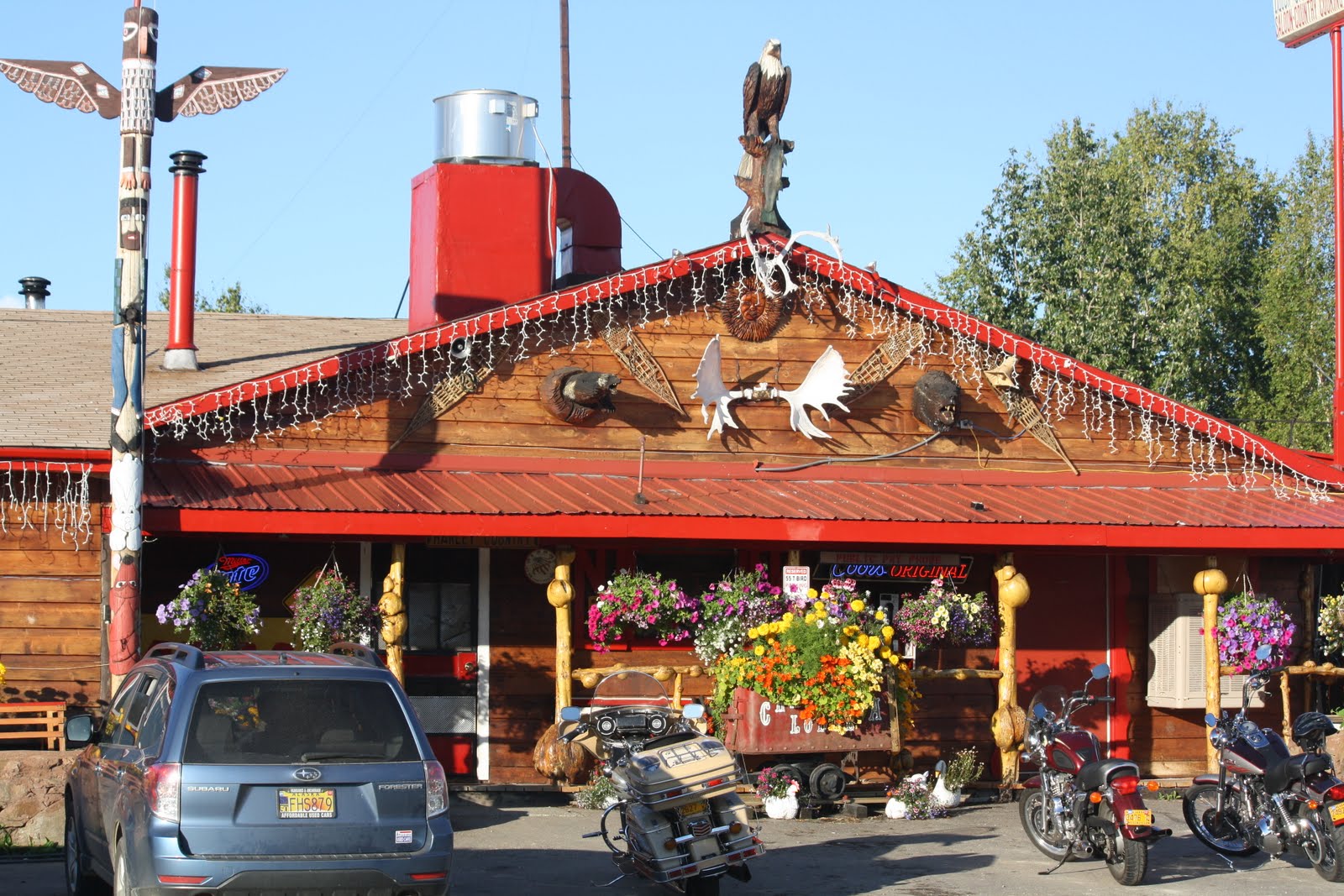
The Chatanika Lodge
From the lodge comes the traditional "Chatanika Days Outhouse Race". Each March five-person teams race a one-mile course, with four pushing and one riding in the specially built "racing outhouses". This is Alaska, folks. It is akin to the bathtub races that take place during Golden Days at Pioneer Park (formerly Alaska Land).

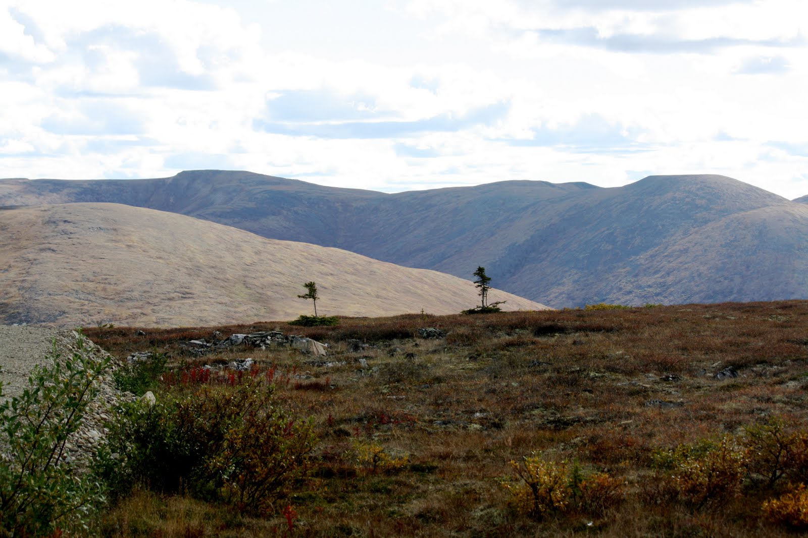
12-mile summit (2,082 ft)
Twelve-mile summit is the divide between the drainages of the Yukon and the Tanana Rivers. The Pinnell Mountain National Recreation Trail begins here.

The views are spectacular -- 360 degrees of White Mountain peaks. We enjoyed a picnic of sandwiches, fruit, red wine and dark chocolate-dipped macaroons at the summit. Nice!

Savannah also had a good time.

Eagle Summit (3,685 ft.)
Much colder, windier, and stark. Eagle Summit is one of the most difficult points on the Yukon Quest sled dog race. Many teams fail here.
At the summit we are above the tree line, but witness two black spruce stragglers loath to give up!

Savannah went crazy on the tundra.

Central, AK.
One of the checkpoints on the Yukon Quest trail. Not much to do here (not even a good cup of coffee). We settled for diet Cokes.

Finally, fireweed and black spruce under an overcast sky on the way back to Fairbanks.
This was not one of the most dramatic of trips I have taken, but the scenery was awesome. Unfortunately, you would need Jeff Jones' photographic equipment to do it justice. We didn't go all the way to Circle as it would have required another 2-hours drive on what the Lonely Planet characterized as possibly ... Alaska's least scenic stretch of road, ... Plus, we both had seen the Yukon River already.
It was a truly beautiful drive, on a beautiful day, and it would be nice to do it again in different seasons.
BTW, I do intend to write to all of you to whom I owe emails!

