Monday, June 27, 2011

The Richardson Hwy to Valdez and the ferry to Cordova

A drive down the Richardson Highway from Fairbanks to Valdez takes you through the Alaska Range, the Chugach Mountains to the southwest, the Wrangells to the southeast, and past a variety of glaciers, lakes and river drainages. It is one of the most scenic routes in Alaska, but it is more often than not covered in clouds and fog, and raining -- which it was on the day we drove down.


The Delta River with the Gulkana Glacier in the background.


The Worthington Glacier.
Just one mile off the road it is the most visited site in the Copper River Basin.


Horsetail Falls is right ON the road.


Savannah in the meltwater pool of the Valdez Glacier just outside the town of Valdez.


The Valdez small boat harbor as seen from the Dock Point Trail on the edge of town.


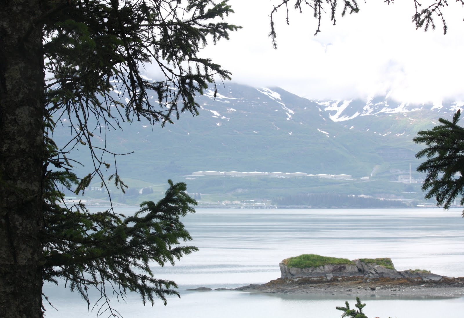
The end of the Trans-Alska Pipline and storage tanks accross the bay from the town. The pipeline runs 800 miles from Prudhoe Bay to Valdez and the town was the site of the disastrous Exon-Valdez oil spill. Another spectacular view from the Dock Point Trail.


A field of wild flowers on the Mineral Creek Trail near Valdez.


The ferry ride from Valdez to Cordova was spectacular even though it was overcast.


Arriving at the port of Cordova.


Gulls at the ferry dock. My only photo of "wildlife" -- not counting Savannah.


The Cordova Rose Lodge B&B

-- which I can highly recommend even though the one-lane drive off the main road I used to refer to as "suicide hill". Mark and Debbie, the managers, were fun, helpful, and incredibly understanding vis a vis the lovely Savannah.


Summer Solstice from my room -- looking across Odiak Slough.


The Child's Glacier as seen from the Million Dollar Bridge -- 50 miles outside of Cordova.


The "Million Dollar Bridge" over the Copper River -- the TRUE bridge to nowhere. The road ends a mile beyond, and there is nothing (not even a maintained trail) to Chitina -- the proposed destination of the road the locals DO NOT want.


Miles Glacier can only be seen from the bridge -- I almost missed it!


Savannah on the Pipeline Lakes Trail on the way back to Cordova from the bridge.


The Cordova small boat harbor. We were very lucky to have sun on the two days we were in town.


The town of Cordova from the small boat harbor.


View from my room the last morning -- just before catching the ferry at 8:30 am.

A trip I would definitely consider repeating!

Thursday, June 9, 2011

Bettles, AK

Bettles is located above the arctic circle and boasts a population of < 30 people. It is the departure point for both the Gates of the Arctic National Park and Preserve and the Kanuti Wilderness Area. It is basically surrounded by the Brooks Range mountains -- accessible only by small plane in summer and by plane or an ice road in winter. It is difficult to convey the considerable charm of this remote location. I had the unique opportunity of caring for 17 sled dogs (2 more arrived mid-tenure) for 2 weeks for a friend of my landlord.


On the day I flew I was lucky the plane first visited the native village of Anaktuvuk Pass which is well north of Bettles. The flight through the Brooks Range was incredible. There were only two of us on the way up and the guy with me commented that people would pay good money just to experience this flight.


One of the many river basins on the way.


River just before landing in Anaktuvuk Pass.


The village of Anaktuvuk Pass from the air.


Our plane (Wright's Air). You can see Savannah's kennel though the door if you look closely.


... from the runway.


The flight from Anaktuvuk to Bettles (it was a perfect day).


The airport in Bettles.


... and from the other end.


The Bettles Ranger Station (where my host works when in town).


The cabin was not dissimilar to mine in Goldstream Valley.


Chica Rica, one of his gorgeous lead dogs


This is Comatose -- whose name, by the way, is truly ironic.
They were ALL the sweetest dogs ever!!! Truly a pleasure to care for.


Mardil! If he looks dusty, it is because he spends most of his time digging. I would have to keep moving his house as it would fall into his holes.


Mahal is the largest of the dogs (and one of the loudest).


This is Shadow (or it is if he has the right name tag on his collar -- not all of them did).


There were many ravens that delighted in torturing the dogs (especially Mardil).


It was a nice walk to the Float Pond which, by the time I left, was completely thawed.


In the winter the Float Pond is where we spent the night to view the northern lights
(which were not in evidence on December 27, 2007, by the way)


Another view of the pond.


... and a flash back to winter of 2007.


The Koyukuk River was quite high during the time we were there.


Savannah cooling off in the river. I kept her on a long leash in the water as I didn't know whether she understood about "currents" -- even though she is a pretty smart dog.


Spring arrived during the two weeks I was there. Compare the two photos of the river.


Savannah appropriated the dog bed in the cabin.


L.C. slept in the cabin with us at night, but when she would emerge from her kennel Savannah would look at me soulfully as if to ask "Are you going to pay attention to HER now?" She is a sweetheart.


This is 2:30 am from the upstairs skylight a couple days before I left. I don't know if it is sunrise or sunset -- it never actually gets dark at this time of year.